Seven Natural Wonders of the World
Similar to the other lists of wonders, there is no consensus on a list of seven natural wonders of the world, and there has been debate over how large the list should be. One of the many existing lists was compiled by CNN
The Grand Canyon is a steep-sided canyoncarved by the Colorado River in the United States in the state of Arizona.
 View from Mohave Point of the Colorado Riverflowing through the Grand Canyon.
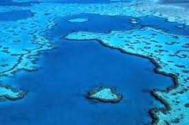
The Great Barrier Reef is the world's largest coral reef system composed of over 2,900 individual reefs and 900 islands stretching for over 2,600 kilometres (1,600 mi) over an area of approximately 344,400 square kilometres (133,000 sq mi).The reef is located in the Coral Sea, off the coast of Queensland, Australia.
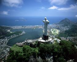
- Harbor of Rio de Janeiro
Rio de Janeiro, commonly referred to simply asRio, is the capital city of the State of Rio de Janeiro, the second largest city ofBrazil, and the third largest metropolitan area and agglomeration in South America, boasting approximately 6.3 million people within the city proper, making it the6th largest in the Americas, and 26th in the world. Part of the city has been designated as a World Heritage Site, named "Rio de Janeiro: Carioca Landscapes between the Mountain and the Sea", identified by UNESCO on 1 July 2012 in the category Cultural Landscape.
Mount Everest (Tibetan: Wylie: jo mo glang ma;Chomolungma; Nepali: , Sagarmāthā "Holy Mother") is the Earth'shighest mountain, with a peak at 8,848 metres (29,029 ft) above sea level and the5th tallest mountain measured from the centre of the Earth. It is located in theMahalangur section of the Himalayas. The international border between China andNepal runs across the precise summit point. Its massif includes neighboring peaksLhotse, 8,516 m (27,940 ft); Nuptse, 7,855 m (25,771 ft) and Changtse, 7,580 m (24,870 ft).
 The north face of Mount Everest
An aurora (plural: aurorae or auroras; from the Latin wordaurora, "sunrise") is a natural light display in the sky particularly in the high latitude (Arctic and Antarctic) regions, caused by the collision of energetic charged particles with atoms in the high altitude atmosphere (thermosphere). The charged particles originate in the magnetosphere and solar wind and, on Earth, are directed by the Earth's magnetic fieldinto the atmosphere. Most aurorae occur in a band known as the auroral zone,which is typically 3° to 6° in latitudinal extent and at all local times or longitudes. The auroral zone is typically 10° to 20° from the magnetic pole defined by the axis of the Earth's magnetic dipole. During a geomagnetic storm, the auroral zone expands to lower latitudes.
 Images of the aurora australis and aurora borealis from around the world, including those with rarer blue and red lights
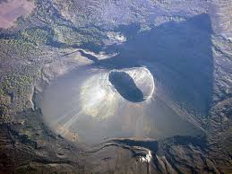
- Parícutin volcano
Parícutin (or Volcán de Parícutin, also accented Paricutín) is a cinder conevolcano in the Mexican state of Michoacán, close to a lava-covered village of the same name. The volcano is unique in the fact that its evolution from creation to extinction was witnessed, observed and studied by human beings. It appears on many versions of the Seven Natural Wonders of the World. Parícutin is part of theMichoacán-Guanajuato volcanic field, which covers much of west central Mexico. It is part of the Ring of Fire.

Rio de Janeiro, commonly referred to simply asRio, is the capital city of the State of Rio de Janeiro, the second largest city ofBrazil, and the third largest metropolitan area and agglomeration in South America, boasting approximately 6.3 million people within the city proper, making it the6th largest in the Americas, and 26th in the world. Part of the city has been designated as a World Heritage Site, named "Rio de Janeiro: Carioca Landscapes between the Mountain and the Sea", identified by UNESCO on 1 July 2012 in the category Cultural Landscape.


New 7 Wonders of Nature
New7Wonders of Nature (2007–11), a contemporary effort to create a list of seven natural wonders chosen through a global poll, was organized by the same group as the New7Wonders of the Worldcampaign.
Iguazu Falls, Iguazú Falls, Iguassu Falls or Iguaçu Falls are waterfalls of the Iguazu River on the border of the Brazilian state of Paraná and the Argentinian province of Misiones. The falls divide the river into the upper and lower Iguazu. The Iguazu River rises near the city of Curitiba. It flows through Brazil for most of its course. Below its confluence with the San Antonio River, the Iguazu River forms the boundary between Argentina and Brazil.

Jeju Province is one of the nine provinces of South Korea. The province is situated on and coterminous with the nation's largest island, formerly transliterated as Cheju or known as Quelpart to Europeans. Jeju Province lies in the Korea Strait, southwest of South Jeolla Province, of which it was a part before it became a separate province in 1946. Its capital is Jeju City.

Jeju Island, South Korea
Komodo is one of the 17,508 islands that make up the Republic of Indonesia. The island is particularly notable as the natural habitat of the Komodo dragon, the largest lizard on earth and consequently named after the island.

Komodo dragon
Komodo Island has a surface area of 390 km² and a permanent population of over 2,000. The inhabitants of the island are descendants of former convicts who were exiled to the island and who have mixed withBugis from Sulawesi. The population are primarily adherents of Islam but there are alsoChristian and Hindu congregations.

Northern tip of the island
The Puerto Princesa Subterranean River National Park is located about 50 kilometres (30 mi) north of the city centre of Puerto Princesa, Palawan, Philippines. The river is called Puerto Princesa Underground River or St. Paul Underground River. The national park is located in the Saint Paul Mountain Range on the northern coast of the island. It is bordered by St. Paul Bay to the north and the Babuyan River to the east. The City Government of Puerto Princesa has managed the National Park since 1992. The entrance to the subterranean river is a short hike from the town Sabang.
Puerto Princesa Subterranean River National Park
Table Mountain is a flat-topped mountain forming a prominent landmark overlooking the city of Cape Town in South Africa, and is featured in the Flag of Cape Town and other local government insignia.It is a significant tourist attraction, with many visitors using the cableway or hiking to the top. The mountain forms part of the Table Mountain National Park. The view from the top of Table Mountain has been described as one of the most epic views inAfrica.
 Panorama from the top of Table Mountain. From left to right are visible Lion's Head,
Signal Hill, Robben Island, the Cape Town city centre,Table Bay, and Devil's Peak.
Ha Long Bay is aUNESCO World Heritage Site, and a popular travel destination, located in Quang Ninh province, Vietnam. Administratively, the bay belongs to Hạ Long City, Cẩm Phả town, and part of Van Don district. The bay features thousands of limestone karsts and isles in various sizes and shapes. Ha Long Bay is a center of a larger zone which includes Bái Tử Long bay to the northeast, and Cát Bà islands to the southwest. These larger zones share similar geological, geographical, geomorphological, climate, and culturalcharacters.

Tourist boats in the bay
The Amazon rainforest also known in English as Amazonia or the AmazonJungle, is a moist broadleaf forest that covers most of the Amazon Basin of South America. This basin encompasses 7,000,000 square kilometres (2,700,000 sq mi), of which 5,500,000 square kilometres (2,100,000 sq mi) are covered by the rainforest. This region includes territory belonging to nine nations. The majority of the forest is contained within Brazil, with 60% of the rainforest, followed by Peru with 13%,Colombia with 10%, and with minor amounts in Venezuela, Ecuador, Bolivia, Guyana,Suriname and French Guiana. States or departments in four nations contain "Amazonas" in their names. The Amazon represents over half of the planet's remainingrainforests, and it comprises the largest and most species-rich tract of tropical rainforest in the world.


No comments:
Post a Comment